Vacant and Derelict Land Mapping
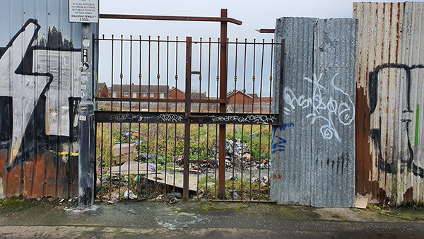
One of the first actions undertaken by the BUILD Shankill Working Group was to identify and map the range of vacant and derelict sites in Greater Shankill and to identify ownership. The process identified 82 sites, over two thirds of which were in public ownership and the remainder were in private ownership or the owner could not be identified.
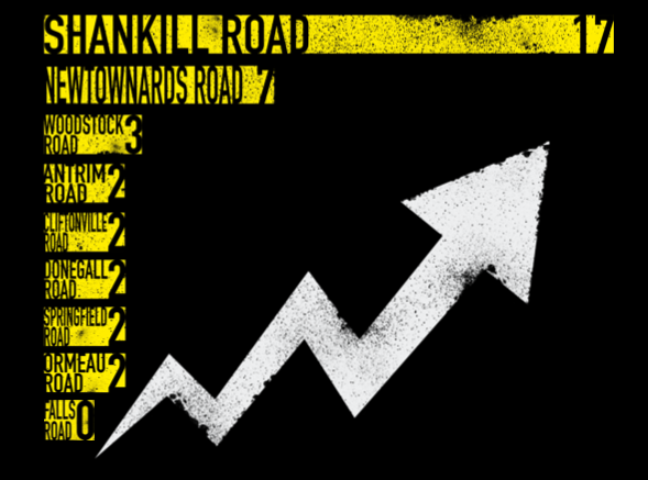
To create a comparator with other areas of the city, an analysis of vacant or derelict sites along main arterial routes to a distance of 1 mile from the city centre was undertaken. Along with the Shankill Road, other routes considered were Antrim Road, Cliftonville Road, Donegall Road, Falls Road, Newtownards Road, Ormeau Road, Springfield Road and Woodstock Road.
Seventeen sites were identified along the Shankill Road, with the nearest comparator being 7 on the Newtownards Road. With 20 sites identified in total across the other 8 arterials routes, there were nearly as many vacant or derelict sites on the Shankill Road as the others combined. This highlights the scale of the issue in Greater Shankill and the challenge of developing responses.
The variety of the 82 sites across Greater Shankill demonstrate the complexity of responding to the issue of dereliction and under-development. Many of the sites are too small to be attractive for development, while others are close to interfaces, contaminated following industrial usage or are prone to flooding.
A dedicated section of this website is currently under construction that will include a full inventory of vacant and derelict land in the area, a description of the ownership status, development status and any other relevant information.